
The Land
Our site offers accessible paths, evolving landscapes, and diverse uses, from horse grazing to community gardens. Explore how we balance conservation, recreation, and sustainable land management.
An Evolving Landscape
Arran has around 20,000 acres of farmland with the majority consisting of grassland for sheep and cattle grazing. However, on ACLI’s land we prioritise biodiversity: allowing nature to take control over most of our holding.

Abandoned Grassland > Mixed Grass/Flowers > Scrub > Pioneer Trees > Woodland
Progressive increase in species diversity; vegetation, insects and animals over time.
BIODIVERSITY & SECONDARY ECOLOGICAL SUCCESSION
The process by which nature re-establishes itself, on land that has been previously used for agriculture, is commonly referred to as ‘secondary ecological succession’.
The former grass-based farmland monoculture has been allowed to diversify naturally, without the influence of agriculture or habitation, leading to the establishment of a mosaic of habitats including ‘unimproved’ grassland, marsh, scrub and woodland which in turn supports a wide range of plants, insects, birds and animals.


An important additional influence are our natural grazers, red deer, which play a key role in this transition. Deer grazing limits the growth of young trees and shrubs by feeding on their foliage, effectively slowing the progression of succession and preventing certain areas from developing into dense woodland. This natural ‘mega-fauna’ grazing therefore helps to maintain the mosaic of habitats across our land. This balance between open grasslands, scrub, and woodland supports a wide diversity of plant and animal species, contributing to the overall health and vitality of our land’s ecosystem.
MAPPING THE CHANGES
Looked at from above, with the benefit of ‘Google Earth’, it is possible to track the changes that have evolved across our land over the last 25 years. In the early 2000s most of the fields in the northern half of the farm were still in active use, either for grazing or silage production. In contrast the southern fields were not in active use.

Aerial Photograph (above) from early 2000s: fields in upper part of picture still being actively cropped for silage

Recent Photograph (above) showing significant development of scrub and woodland in former fields along lower half of photograph
Winding forward to the present time, there is a marked contrast between the northern fields which typically still have an open aspect consisting of ‘unimproved grassland’ or ‘marshy grassland’ versus the southern fields which have transitioned to scrub and woodland. However, we can still see field outlines over most of the land: typically expanded hedgerows containing gorse, bramble and thorn-trees.

ECOLOGY AND ACCESS
We have mapped the ecology and have built a network of paths, which allow the visitor to observe the range of eco-systems that our land supports, as well as storyboards to illustrate constituent habitats.

Map of Habitats

Access Track (yellow) and Paths (green and orange) with Field numbers and Story Board Locations

GRAZED PASTURE
This is a typical piece of grazed pasture: fenced, grass dominated and apart from a few wildflowers and docks, is essentially a ‘monoculture’ intended to provide nourishment for sheep, cattle or in this case horses. The opportunity to support other native insects or animals is very limited.
UNIMPROVED GRASSLAND
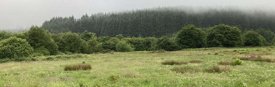
When left to its own, without the pressure of intense grazing, abandoned grassland will begin to revert to a more complex state supporting an increased number of grass, flower and rush species. Ecologists often refer to this as ‘unimproved grassland’. Wherever possible we have left fields unfenced in order that these spaces can be enjoyed as open and increasingly wild places.
Within the drier grass dominated portions of the large field in the NW corner of our holding (field 9) a large population of voles has established itself, evidenced by grassy mounds and burrows which in turn support breeding barn owls and other raptors.


MARSHY GRASSLAND
In wetter fields we typically see a significant amount of rush as well as a wide selection of wetland loving flower species such as the cuckoo flower, marsh marigolds and hemlock which in turn attract their own specific pollinators.
Ground conditions and vegetation cover are conducive to amphibians such as frogs, toads and newts which in turn attract bird species such as herons.

NATIVE SCRUB AND WOODLAND
Where former fields have been left undisturbed/ unused for decades, ecological succession can move beyond Unimproved Grassland/Marshy Grassland into Native Scrub. The land surface becomes very hummocky and covered with scrub species such as gorse and brambles. Pioneer tree species such as downy birch and willow develop and especially in places with a high concentration of scrub cover which protects young trees from deer grazing. Through time and as the concentration and height of trees increase a ‘closed canopy’ of woodland develops and this is something we observe along the south-east boundary of our land.

NATIVE WOODLAND - ATLANTIC HAZEL
Within the steep watercourses that cross our land we are fortunate to have the remnants of indigenous temperate rain forest specifically Atlantic Hazel Woods. Unlike Hazels that are actively coppiced elsewhere in the UK, these are largely unmanaged woods, where there is a mixture of stems of all ages with many older trees leaning to near horizontal throwing up new vertical stems. Another feature of old well-established groves is a rich range of mosses, lichens and ferns (so called ‘epiphytes’) hosted directly by the bark of mature trees.

BRACKEN & TREE PLANTING
Although every effort is made to allow nature to remain in control some management measures are taken where necessary. As can be seen across Arran, if left unchecked, bracken can swamp nearly all other plant species and become an effective monoculture. Bracken is not tolerant of wet or shady ground but does require to be actively cut within open grassland to ensure that indigenous grass and wildflowers are not wiped out.
The other approach, where bracken has developed in sloping areas, typically between former fields, is to plant trees which, when established, will shade the bracken out. Tree planting is done with indigenous broad leaf species including Alder, Oak, Willow, Hazel, Rowan, Aspen and Rowan; 1000’s of trees have been planted in the last 10 years.


MEADOW CREATION
With the help of a biodiversity grant from North Ayrshire Council, we are working to actively increase wildflower density within grass dominated fields (8, 9 and 10). For wildflower species to gain a foothold it is necessary to weaken the resident grass which can dominate if soil fertility is high. This is done by introducing ‘yellow rattle’ a semi-parasitic species that takes part of its nourishment from grass, thereby making it easier for other wildflower species to become established. This, in turn, should significantly increase a range of pollinator species including wild bees, moths and butterflies.
Access

There are multiple access points to the site, and we continue to work to ensure it is accessible to as many as is possible.
A main track runs from the northeast corner (Golf Course Road) to the southwest corner (Glenashdale Track), effectively bisecting the land. From this track, a network of paths has been created to provide access to most of the fields. Additionally, a bridge has been built to allow easy crossing into the westernmost field. Informal access to the land is also possible at two points where it meets the main logging track to the west.
For those walking solely on the track, trainers or similar footwear should be sufficient. However, sturdy boots are recommended for walking off-track, as paths can be muddy and uneven in places. Visitors should also be mindful of the potential for ticks; we advise dressing appropriately, avoiding uncut undergrowth, and checking thoroughly for ticks on all parts of the body after walking.
Unauthorized vehicles are not permitted on the site, but there is a small car park near the Golf Course entrance for visitors.
Gallery


